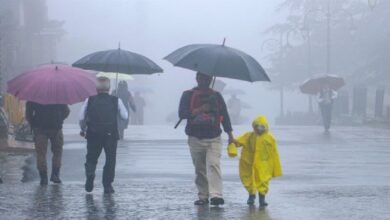
Karnataka Weather Update Monsoon Weakens But Rain Likely Across Coastal and Inland Districts
Karnataka may see moderate rainfall across coastal districts and parts of the interior as the southwest monsoon weakens slightly, while strong winds remain possible in several areas.

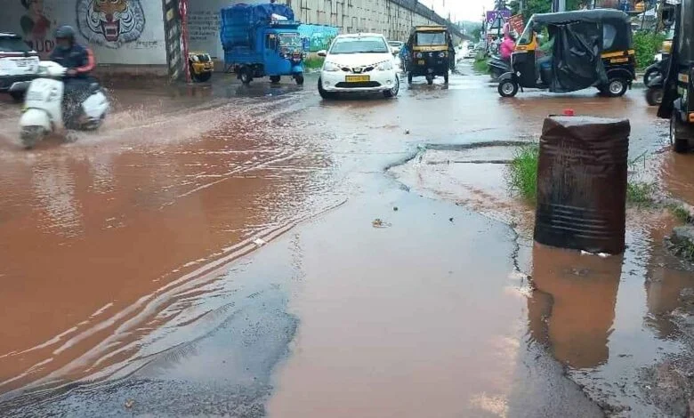
Karnataka is likely to continue receiving rain over the next couple of days even though the southwest monsoon has shown signs of weakening across the state. According to the latest weather outlook, coastal Karnataka is expected to remain the main area of rainfall, while several districts in the southern and northern interior regions may also receive light to moderate showers.
The weather situation has changed after several parts of Karnataka witnessed active monsoon conditions in recent days. While the intensity of rainfall may not remain as high as before, the weather is still expected to remain unsettled in many districts. The India Meteorological Department has forecast moderate rainfall in several areas on August 11, with similar conditions expected to continue in parts of the state on August 12.
Coastal Karnataka is expected to receive the most widespread rainfall during this period. Dakshina Kannada, Udupi and Uttara Kannada are likely to experience moderate rain across many locations. Along with rainfall, these districts may also experience winds reaching speeds of around 30 to 40 kilometres per hour.
The combination of rain and strong winds could affect travel conditions in some coastal areas, particularly during periods of heavier showers. Residents and commuters may therefore experience temporary changes in road conditions and visibility.


The northern interior districts are also expected to receive rainfall, although the coverage is likely to be more limited compared with the coastal belt. Gadag, Haveri, Dharwad, Belagavi, Koppal, Bagalkot, Raichur and Yadgir may see light to moderate showers at a few locations.
Winds moving at speeds of around 30 to 40 kilometres per hour are also possible across parts of northern Karnataka. The rainfall may not be widespread in every district, but isolated showers could provide some relief from dry conditions in areas that have received less rain.
Southern interior Karnataka is also likely to remain under the influence of the monsoon. Bengaluru Urban, Bengaluru Rural, Ballari, Chamarajanagar, Chikkaballapur, Chikkamagaluru, Chitradurga, Davanagere, Hassan, Kodagu, Kolar, Mandya, Mysuru, Ramanagara, Shivamogga, Tumakuru and Vijayanagara may receive moderate rain at some locations.
For Bengaluru residents, the forecast means cloudy conditions and occasional showers could continue in parts of the city. Rainfall may vary significantly between neighbourhoods, as is common during the monsoon season. Some parts of the city could receive noticeable showers while other areas remain relatively dry.
The weather outlook for August 12 indicates that coastal Karnataka will continue to receive rainfall. Dakshina Kannada, Udupi and Uttara Kannada are expected to see moderate rain at several locations. The coastal belt is likely to remain wetter than most interior parts of the state.
In the northern interior, Gadag, Haveri, Dharwad, Belagavi, Koppal, Bagalkot, Raichur and Yadgir may receive rain at a few locations. The intensity is expected to range from light to moderate depending on the area.
Several southern interior districts may also experience showers on August 12. Shivamogga, Chikkamagaluru, Hassan, Kodagu, Mandya, Mysuru, Chamarajanagar, Ramanagara, Bengaluru Rural and Bengaluru Urban are among the areas where light to moderate rainfall is possible.
Recent rainfall records show that coastal Karnataka has received relatively better rainfall compared with several interior areas. During the 24 hour period ending Monday evening, Subrahmanya in Dakshina Kannada recorded around 5 centimetres of rainfall. Munirabad in Koppal recorded around 4 centimetres, while Beltangady in Dakshina Kannada received around 3 centimetres.
These rainfall figures indicate that the coastal belt continues to receive stronger monsoon activity even as the overall southwest monsoon condition across Karnataka has weakened.
The difference in rainfall intensity between coastal and interior Karnataka is not unusual during the monsoon season. The Western Ghats and surrounding geographical features often influence the distribution of rainfall, resulting in heavier showers in some locations while nearby interior districts receive comparatively less rain.
For farmers, the continuation of rainfall in parts of the state could provide useful moisture for agricultural activities. However, the uneven distribution means that the impact will differ from one district to another. Areas receiving repeated showers may need to monitor excess moisture, while regions receiving limited rainfall may continue to depend on further monsoon activity.
The possibility of strong winds along with rain is another important aspect of the forecast. Residents in affected areas should remain cautious around trees, temporary structures and other objects that could be affected by gusty conditions.
Overall, Karnataka is not expected to experience a complete break from monsoon weather. Instead, rainfall is likely to continue in phases, with coastal Karnataka remaining the most active region. Several southern and northern interior districts are also expected to receive showers, although the coverage may be more scattered.
The next two days are therefore expected to bring a mix of cloudy weather, intermittent rainfall and moderate winds across Karnataka. While the southwest monsoon has weakened slightly, the weather system continues to remain active enough to bring rain to several parts of the state.