

See Your Name Written Across Earth with NASA New Satellite Powered Tool
NASA introduces an interactive feature that lets users create their names using real satellite images of Earth landscapes, combining science, creativity, and global geography in a unique digital experience
A new digital initiative is turning heads as space technology meets creativity in an unexpected way. The idea is simple yet fascinating. People can now see their names formed using actual images of Earth captured from space. This concept, introduced by NASA, is gaining attention for blending science with a personal touch.
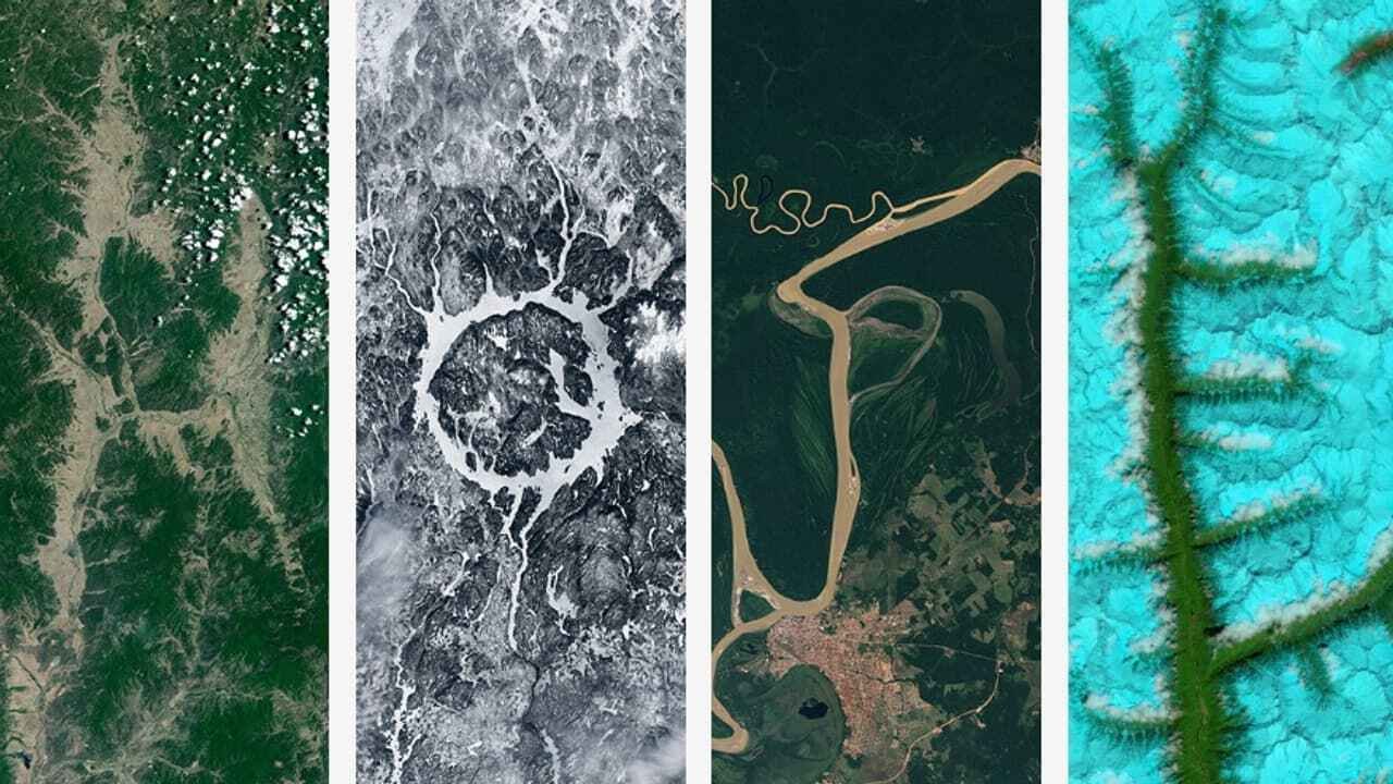
The feature, known as Your Name in Landsat, uses a vast collection of satellite images to create letters that resemble natural landforms. These images are not artificially generated. Instead, they come from real geographical patterns such as rivers, deserts, forests, and coastlines that coincidentally form shapes similar to alphabets.
What makes this tool stand out is how it brings global geography closer to everyday users. Once a person enters their name, the system searches through thousands of satellite images to match each letter with a natural formation found somewhere on Earth. The final result is a name constructed entirely from real locations across the planet.
Each letter in the generated name is linked to a specific place, giving users the opportunity to explore where that image was captured. This adds an educational layer to the experience, allowing people to learn about different terrains and regions while engaging with the tool.


The feature was rolled out as part of efforts to spark greater interest in Earth science and satellite imaging. By making the experience interactive and personal, it encourages users to look at the planet from a new perspective. It also highlights how satellite technology is not just for research but can be used in creative and engaging ways.
To use the tool, users simply need to visit the official platform and type their name using standard English letters. Within seconds, the system assembles a visual representation using satellite imagery. The final creation can be downloaded or shared, making it a popular option for social media as well.
Another interesting addition is an image gallery that showcases dozens of satellite photos resembling alphabet shapes. This gallery allows users to browse and learn more about the unique landscapes that form these natural patterns.
Beyond entertainment, the initiative serves a broader purpose. It draws attention to the diversity of Earth’s surface and reminds people of the beauty and complexity of the natural world. By connecting personal identity with global geography, the tool offers a meaningful way to engage with science.
As digital experiences continue to evolve, projects like this demonstrate how technology can make learning more interactive and enjoyable. What once required scientific expertise is now accessible to anyone with an internet connection, turning curiosity into discovery in just a few clicks.